While everyone has seen common types like stratus and cirrus, there exist cloud formations that I bet you’ve never even dreamed of!
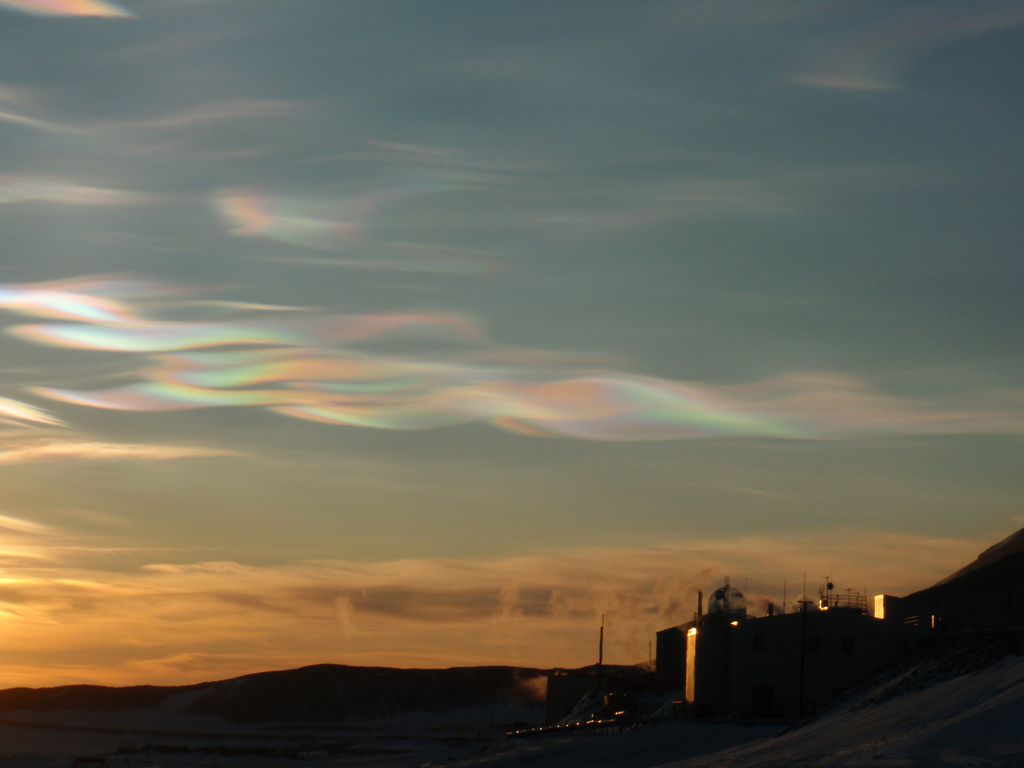
Polar Stratospheric Clouds
Also known as Nacreous clouds, from the French “nacre” (meaning Mother of Pearl), these clouds boast not just a fantastic shape and size, but also washes of color that paint across the sky like brush strokes. However, with their beauty also comes thorns. Nacreous clouds are formed in the stratosphere of the Polar extremes. Due to their altitude, they receive light from the sun even after it has descended far beyond the horizon. They form far up enough that their crystalline shape allows chlorine to react rather than stay in its normally-inert form, which isolates chemicals that normally defend the ozone from destruction. In essence, these clouds are anti-sunblock for the planet.
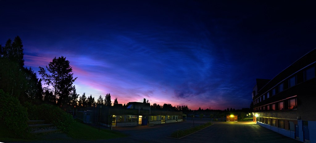
Noctilucent Clouds
Interestingly, these clouds have only been documented after 1883’s eruption of the volcano Krakatau. They can only be observed a few minutes between day and night, when it’s just too dark to see properly. Theories as to why these clouds exist come from the fact that the eruption sent ash 80 kilometers into the sky. This fine ash allowed the formation of moisture particles around it. Now, without the ash in the sky, these clouds still exist, possibly because of the pollution from industrial plants. They are the highest known clouds in Earth’s atmosphere. They require dust or other microparticles, water vapour, and incredible cold temperatures in order to form.
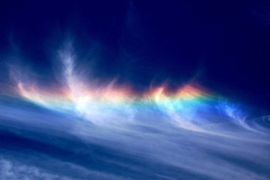
Fire Rainbows
Officially called a Circumhorizontal Arc, these formations are not actual fire but definitely are rainbow-like, in a technical sense. This phenomenon is observable when plate-shaped ice crystals suspended in the atmosphere, either in cloud form or free-floating, are hit by sunlight at just the right angle, and refract like a prism. While technically not a cloud themselves, they can take place in clouds, like the recent ones captured in South Carolina.
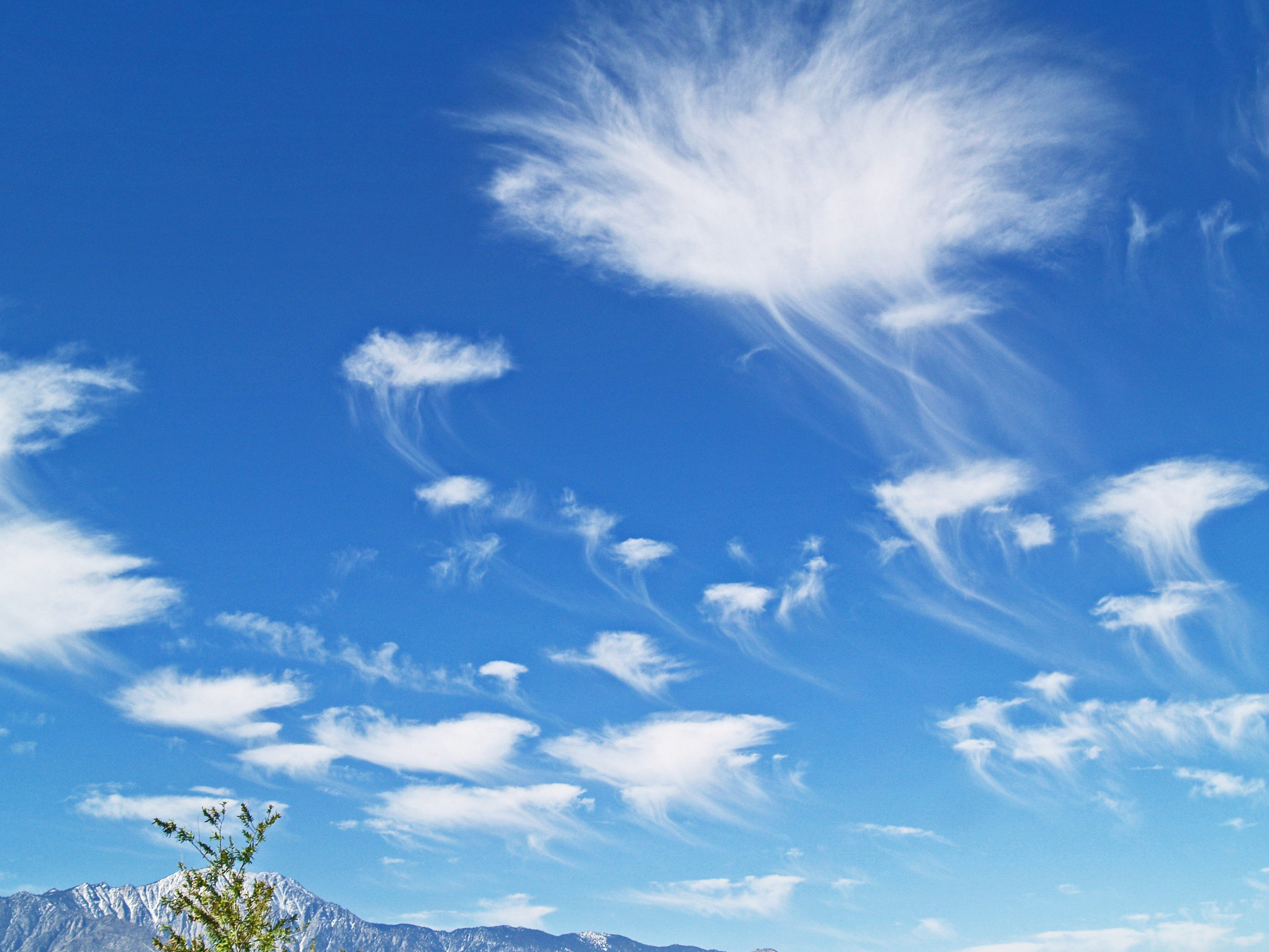
Altocumulus Castelanus Clouds
A cursory glance at these clouds will have you expecting the giant sky jellyfish invasion any second. It is because of their strange appearance that they are colloquially called Jellyfish Clouds. These clouds are formed when two layers of very dry air sandwich a layer of moist air. Basically, warm air rises through the moist layer, forming water vapor particles. Those particles gain enough mass to be too heavy to continue rising, and plunge back down toward the moist air layer, where they gather more of the water from that layer and fall as rain. However, the dry air below the moist layer causes the rain to evaporate before it hits the ground, creating the tentacle-like rain-cloud formation under the pillowy body formation. Featured photo credit: Kevin Dinkel via farm4.staticflickr.com


